
Surveying / Mapping
Drone services provide efficient, safe, and accurate methods of collecting survey grade data that aids our conventional surveyors in the field. Using both Photogrammetry and LIDAR collection processes SESI is able to collect topographic survey data. This allows for quick turn around time for our clients and in house surveyor teams. Drones also provide high resolution ortho images that allow for tracing of existing features on project sites. See below for an explanation on LIDAR and Photogrammetry.
Photogrammetry
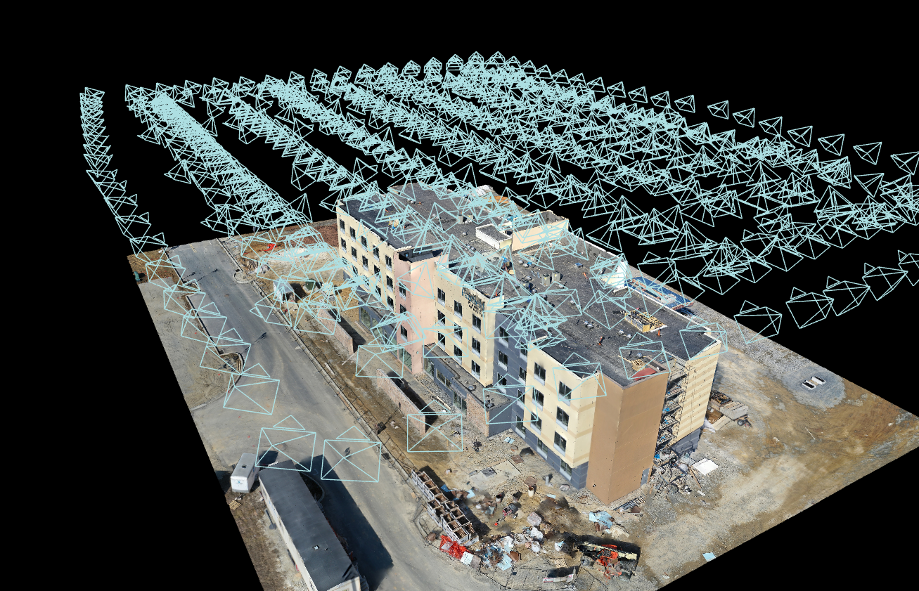
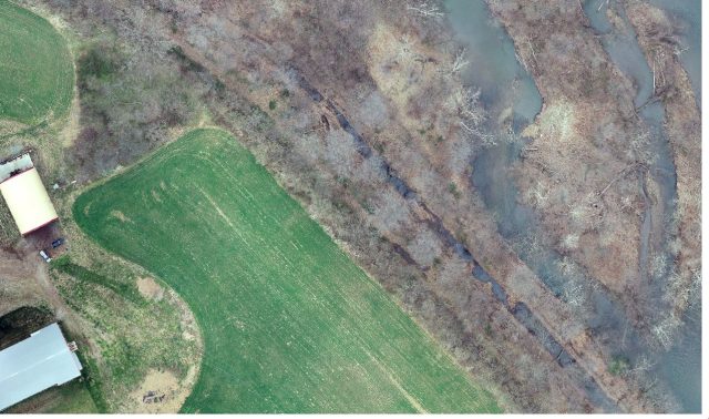
Photogrammetry is the process of using drones to capture large volumes of 2D aerial images over a geological area. All of these images are geotagged meaning they have GPS coordinates which allow for precise mapping. These images are then compiled within software to create large scale high resolution ortho maps. These maps can then be used to create 3D models, topographic contours, digital surface models. and much more.
Photogrammetry is very useful for project areas with low vegetation or developed project sites that have a lot of existing features that require a high resolution image to trace existing features. SESI utilizes the DJI M-300 RTK + DJI Zenmuse P1 (45 megapixel) sensor for its photogrammetry services.
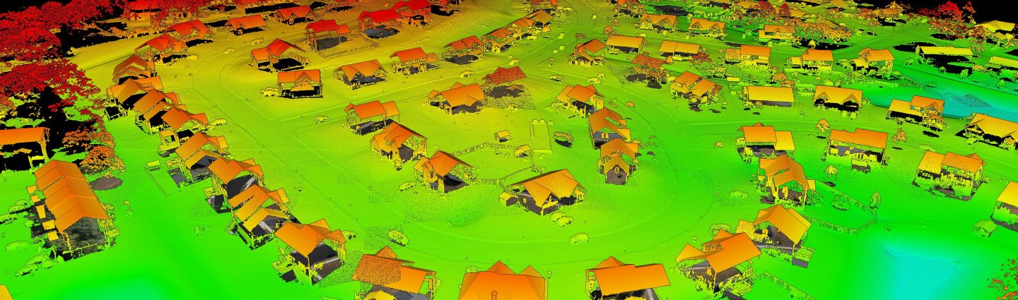
LIDAR
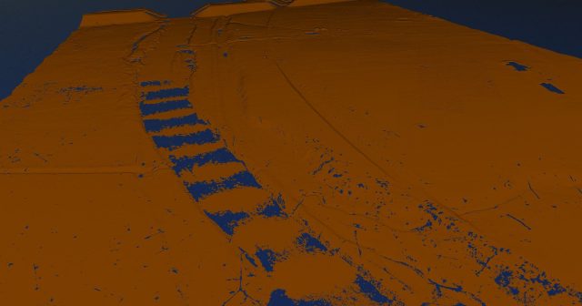
LIDAR stands for Light Detection and Ranging. This is a process that uses drones to capture detailed elevation point clouds of a project site using laser light pulses. These pulses shoot down to the earth and return similar to radar waves. Each pulse return is scanned into a point which is stored in the point cloud.
The benefit of LIDAR is due to the ability to capture data under vegetation. LIDAR also is better at capturing vertical objects like building faces. Another use is for LIDAR is the ability to locate electrical utility wires. SESI utilizes the DJI M-300 RTK + DJI Zenmuse L1 LIDAR sensor for its aerial LIDAR services.
Project Spotlight: LVRT Phase 10b Aerial Survey
Project DetailsLVRT Phase 10b Aerial Survey

Description:
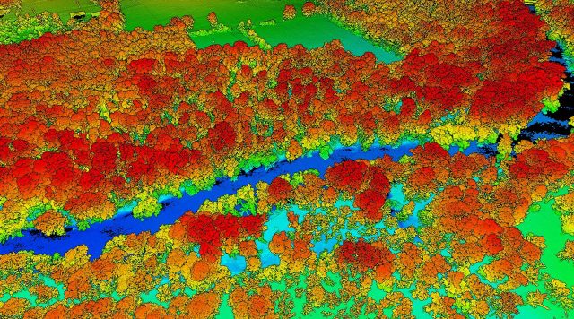
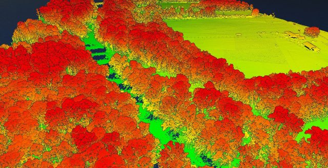
Lebanon Valley Rail Trial runs 14.93 miles from Cumberland Street and runs South to the Lebanon/Lancaster County line. Phase 10b included about 2.5 miles of the trail. This project required SESI drone team to capture over 420 acres of woods along the Swatara Creek to capture topographic data of the LVRT trail that needed to be restored. The leaves were off for this project and the date flown was on 3/25/2022. Leaves off is the best way for the LIDAR sensor to capture data under forest. This project required 5 separate flights which ended up collecting 5 billion LIDAR points and 3500 photos. This data was captured by the DJI M-300 RTK + DJI Zenmuse L1 LIDAR sensor. The data was used to create Digital Elevation models, contours, and high resolution imagery for tracing existing features.
Highlights:
- 4 Miles long Lebanon Valley Rail Trail
- Largest Creek LIDAR Project
Project Details
Acreage: 420 acres
Category: Surveying
Client: Wilson Consulting Group
Project Type: Aerial Drone LIDAR Survey